

A powerful winter storm swept across the Midwest United States in March 2026, but it didn't start with snow or wind at all. Instead, it began thousands of miles away, high in the atmosphere, where the Arctic started to lose its usual structure and stability.
Meteorologists watching the larger-scale patterns could see the development days in advance, as the Arctic Oscillation shifted deeper into its negative phase. This shift allowed a large mass of Arctic air to break away and move southward into the Midwest, setting the stage for a much more significant event than a typical cold spell.
By the time the first alerts appeared, the most important part of the story had already happened. The Arctic air reached the Midwest and began to spread outward, pressing south and gradually reshaping the entire region.
The shift in temperature was stark, with temperatures dropping sharply into sub-zero territory to the north while conditions remained closer to seasonal norms to the south. A narrow but powerful zone of contrast formed between the two, and that's where the atmosphere started to respond.
This shift traced directly back to the Arctic Oscillation, which allowed an unusually large and dense Arctic air mass to move south. Combined with available moisture, it created a sharp temperature gradient capable of fueling storm development.
Storms don't just appear, they build from imbalance. In this case, that growing contrast became the energy source for a low-pressure system that didn't just pass through, but organized and strengthened, maintaining intensity as long as the imbalance remained.
From a distance, the setup looked straightforward, but on the ground, it rarely unfolds that cleanly. Local conditions began to vary in ways that only surface observations could fully capture, with precipitation falling as freezing rain instead of snow in some valleys.
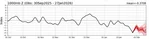
The varying wind patterns also played a significant role in shaping the storm's impact. In areas where terrain created natural funnels, the wind monitors deployed on Western slopes captured dramatic differences in wind speeds and directions.
As the storm developed, it highlighted the importance of considering local conditions and weather stations when predicting winter storm impacts. By taking into account these factors, meteorologists can provide more accurate forecasts and help protect communities from the worst effects of severe weather.
The Arctic Oscillation plays a crucial role in shaping our weather, and its negative phase can lead to significant changes in temperature and precipitation patterns.


