

In early April, a NOAA Ship Rainier is set to embark on an ambitious project to map and characterize over 8,000 square nautical miles of federal waters in the Pacific Ocean. This endeavor is part of the Department of Commerce's efforts to implement the U.S. Offshore Critical Minerals Mapping Plan, which was outlined in President Trump's Executive Order 14285. The plan aims to unlock America's offshore critical minerals and resources, a goal that has significant implications for the country's energy and economic security.
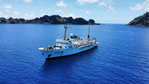
The NOAA Ship Rainier is a hydrographic survey ship staffed by experienced NOAA Corps Officers and professional mariners. Equipped with state-of-the-art technology, including multibeam echo sounders, the ship will conduct two survey legs to gather critical data on the seafloor. The first leg will focus on mapping deep water areas using these advanced sonar systems, while the second leg will utilize autonomous underwater vehicles from Orpheus Ocean to acquire high-resolution seabed imagery and geological samples.
The partnership between NOAA and Orpheus Ocean is a significant one, as it brings together two organizations with expertise in ocean exploration and critical mineral mapping. The use of autonomous underwater vehicles will allow for more efficient and cost-effective data collection, while the collaboration will facilitate the sharing of knowledge and best practices in this field.
The resulting maps and images of these federal waters will be publicly accessible and will provide valuable information to NOAA, other federal agencies, and interested parties. These products will help inform decision-making related to critical mineral exploration, research, and management projects, as well as support the development of new industries and economic opportunities.
The project's focus on deep-ocean data collection is a significant step forward in our understanding of the ocean's geology and ecosystems. By generating high-quality, deep-ocean data, NOAA will be able to better identify areas with potential for critical mineral deposits, which could lead to new discoveries and a more sustainable use of these resources.
The mapping of these federal waters will also have broader implications for the country's energy security and economic development. As the demand for critical minerals continues to grow, it is essential that we have a better understanding of their distribution and availability in our oceans. This project will help inform policy decisions and support the development of new industries and economic opportunities.
The NOAA Ocean Exploration Cooperative Institute plays a crucial role in this project, providing expertise and resources to support the collection and analysis of critical data. The partnership between NOAA and Orpheus Ocean demonstrates the importance of collaboration and knowledge-sharing in advancing our understanding of the ocean's geology and ecosystems.
As the project progresses, it is likely that new discoveries will be made, and our understanding of the deep ocean will continue to evolve. The mapping of these federal waters will provide a valuable foundation for further exploration, research, and management projects, including activities related to critical minerals.
The success of this project will depend on the effective collaboration between NOAA, Orpheus Ocean, and other stakeholders. By working together, we can unlock the full potential of our oceans and ensure that we have the data and knowledge needed to support sustainable economic development and energy security.
Ultimately, the mapping of these federal waters will provide a valuable contribution to our understanding of the ocean's geology and ecosystems. The resulting data and products will inform decision-making related to critical mineral exploration, research, and management projects, supporting the development of new industries and economic opportunities for years to come.
The mapping of these federal waters will provide valuable insights into the geology of the area, which could lead to new discoveries and a better understanding of the deep ocean.